Green Ridge: June 17 – 19, 2011

•September 15, 2011 • Leave a Comment

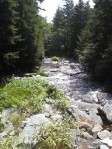
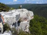
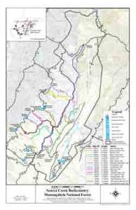
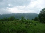
Green Ridge State Forest lies in the western Maryland pan-handle just 45 minutes west of the more well known Catoctin Mountain, and is situated so: that the willing hiker only needs to take one step to the north and they are in Pennsylvania, to the east and they are in West Virginia, and to the west – more empyy un-explored Maryland woodlands.  It is the latter that Green Ridge is all about.  The forest is un-kept, un-ruly, and largely un-inhabited.  Visitors have a chance to see (and even swim in) one of the better preserved sections of the Potomac River, as it winds its way through the Appalachians, free to surge it’s waters far from the footprints of civilization.  Another notable waterway in the forest is the, now retired, C & O Canal, which in its day, served as the main trading route between the Ohio River and Chesepeake Bay.  Although the C&O’s algae and sludge infested appearance doesn’t garner many lengthy glances, the towpath that follows it is a favorite amongst backpackers and mountain bikers for its gentle terrain, scenery and most importantly – the Paw Paw Tunnel.  For hikers that wish to add that extra edge of excitement, the Paw Paw is a 950 foot long tunnel that channels itself right through the heart of the mountain.  Although light is visible at both ends, it’s said to be deceiving to the eye, as the middle is pitch black, damp and cold.  The other trails throughout the forest have their own reputation for demanding the hiker to crab walk, or even employ hand-over-hand techniques to conquer the slopes.  Now with all this build you would think this would be a prime woodsboy hiking location…think again. 

Steven, Andrew, Matt, and Daniel made the drive down 270 in the pouring down rain, and we were already running late.  The time was pushing 10pm and we still needed to check in at the ranger station to get our permit, and make the shuttle to the drop-off point, drop a car, AND make it back to the first night’s campsite.  Looking at the map, they would all be do-able drives, and we would have plenty of time to feast before we went to sleep.  However, once we took care of bussiness at the office we took off down the road.  As we headed into the forest we quickly realized that the backcountry mountain roads were very to almost undriveable, at least for cars without 4×4.  Since it had just rained, the muddy one lane paths (won’t even call them roads) were highly slippery and already incredibly eroded.  One mile took ten minutes, and suddenly the meager 15 miles it would take to drop a car and head to camp seemed dim in our minds.  Still it was only 11:30, so continued cautiously, resigning ourselves to the mear fact that it would take as long as it needed to.  All that was shot when the road emptied into a big clearing with no discernible way to go.  We drove in circles for a bit, backed in, backed out, checked the map, turned on the GPS until we finally realized – game over.

We retreated back to the ranger station where we looked at the big map and decided to head over to a nearby car camping site.  We had already paid our camping fees so we figured we could camp anywhere we wanted to.  We pulled in and the sigh of the campsite boosted everyone’s morale, because it was spacious, but more so just because we could get out of the car.  We gathered our wood and started our blazing fire.  Steven cooked up his famous “Bison Royale”, which Matt dubbed the meal, with the juicy bison meat, cous and stir fry veggies with plenty of salt and pepper.  We sipped some whiskey and planned the next day’s adventures.  We worked out a plan to salvage our botched backpacking trip, which was to drive to Bond’s Landing the next day and have another leisurely day of car camping and swimming in the river before we do a one night backpack back to our current location on the following day.  Everyone seemed energized about that plan, so we ate more food in celebration.  We talked the rest of the night about Game of Thrones before tiredness finally took us at 4AM.

The next day was the kicker.  The drive to Bond’s Landing was nothing short of frustrating, bumpy, and moderately dangerous.  We made a quick stop to buy some more beer at a camp store, before continuing our crawl to the campsite.  Bill’s Place, which is supposedly the one saving grace of the area was closed for the day and no one knew why – go figure.  When we finally reached Bond’s the campsite, yet again ,was a welcome sight.  For all the terrible roads, this place sure knew how to make a good campsite.  We settled in and set up our tents, drank some beers, and finally decided to go swimming in the Potomac.  Weather was perfect – sunny, blue sky, mid-70s.  We threw rocks, rode rapids, waded, sat…pretty much all the things you could do swimming in a river.  Little did we know this would be the peak of the trip.  Huge thunder storm rolled in a few hours later and we holed up in Matt’s car as it passed.  We took another hour to re-set up camp and get the fire going before some hell-bent forest rangers rolled up and shined their flashlights in our faces, asking all sorts of questions.  We were stunned that they decided to choose us because we weren’t noisy, didn’t do anything wrong as far as we could tell.  Turns out they were mad we didn’t fill out our permit correctly.  Even though we paid money, they were concerned we didn’t tell anyone we would be at this specific site.  They combed through the rest of the campsite, looking at everything, rifling through our car, asking more pesky questions.  When they finally took off we were all left a little dumbstruck, shaken, and feeling a little taken advantage of.  The mood of the camping trip had been killed and we all knew it.  We left the next day thinking luck wasn’t on our side for this one.  We regained our spirits at an awesome Mexican place where we all ate Burrito Grandes – California style.  Can’t wait to get back to Green Ridge and actually backpack – no car camping next time!   

Pics coming soon!

McAfee’s Knob to Tinker Cliffs: February 18 – 20, 2011

•July 31, 2011 • 1 Comment

View of McAfee's Knob from the AT

In Catawba,VA there lies a 14 mile stretch of the AT known as the Triple Crown, where hikers can achieve, what is regarded, as the three best vistas in Virginia: Dragon’s Tooth, McAfee’s Knob, and Tinker Cliffs.  McAfee’s is said to be one of the most photographed spots along the whole AT, in good company with Clingman’s Dome in TN, Mount Katahdin at the trail’s northern terminus, and the Presidential Range in New England.  For the sake of time, we forewent Dragon’s but were able to conquer the latter two for a successful weekend of hiking in the Jefferson National Forest.  Along with the normal array of Woodsboy’s, plenty of other first-time group members came along including Tyler Lorenzi*, and Matt’s roomate, RJ.  It was also nice to meet up with Woodsboy veteran, Bryant Boyle.

Disembarking from the parking lot

The group disembarked from the McAfee’s parking lot, and began the four and a half mile ascent to our premiere vista.  Even though it was the end of February, the temperatures were in the low 60s, and the sky was clear and sunny, so we paused to shed our outer layer as we warmed up.  Heading north on the AT, the trail skirts the side of the mountain just below the ridge, gently rolling, never really demanding any really steep climbs.  At the Catawba shelter we stopped to use the spring to refill our water before continuing up through the power lines – a sign we were getting close.

View from McAfee's Knob *1

Probably the hardest of climbs, though still not that long, was the final ascent to McAfee’s, which ended up being everything we wanted – stunning and beautiful.  Wide open and un-obstructed views of Tinker Cliffs to the north, and all of the Catawba valley lay out in front of us.  The wind whipped our faces, yet we took no notice.  On a clear day, one can see as far south as Dragon’s Tooth, and as far north as part of downtown Roanoke.  From the knob, we spied our campsite for the evening, just a mile north on the trail, underneath a power line in a small clearing.  After leaving the knob we descended through Devil’s Kitchen, an expansive rock maze, complete with plenty of nooks and cranny’s for camping opportunities.  It’s said that at the end of the last ice age, when the continents were crashing and expanding, Africa gave us a nice upper cut, causing a majority of these rocks to explode towards the surface – whoa!

Our campsite for the weekend


When we reached the clearing with the power lines, Andrew led us out into the clearing to find the campsite he had read about on the forums.  As expected it was a huge open campsite in a nice meadow, with a beautiful overlook of the local Roanoke airport to the east.  With such a big group, the camp chores got done quickly and Steven went about getting the camp feast all set to go.  Due to Bryant’s willingness to lug up a nice cast iron skillet, we grilled the burgers more easily, and enjoyed plenty of camp fire cous cous to top everything off.  Temps were still in the low 60s, so huddling the camp fire wasn’t necessary (unlike last winter – see Signal Knob post).  We passed around a bottle of Jack and some jungle juice, and watched the planes land in the distance.  We had a nice shanty town of tents set up, so when 2AM rolled around, we hit the sack.

Views of Carvin Cove Reservoir

Saturday’s plan was to do an eight mile out and back to Tinker Cliffs to the north, so when we woke up we made a nice pot of instant coffee (dubbed motor oil by Bryant), and threw some snacks and water into our packs for the day.  It was nice not having to pack up the tents for once and lug all our gear with us, especially since there were some legitimate climbs to reach Tinker and we all appreciated the lighter load.  On the way, there was view after view of the Carvin Cove Reservoir to the east, as well as Catawba Valley to the west, as the trail barely covered the width of the ridge and the trees hadn’t bloomed yet.

Lunch on Tinker Cliffs

The views from Tinker were far more expansive than McAfee’s, as one could walk up to a half mile to achieve a variety of different vistas.  Looking south, we could see McAfee’s and still spot our campsite, so it was fun seeing how far we had come.  The weather was clear and sunny, so we were definitley getting the best out of this section of the triple crown.  We took lunch on the rocks and some of us laid down to take naps before headed back.  Even though, most of the Woodsboys aren’t a fan of backtracking, the section of the AT between McAfee and Tinker are so riddled with vistas it was worth seeing them again.  When we got back to our campsite  most of our tents had partially blown away since the wind was blowing at record speeds that weekend.

Gettin dinner ready on day 2


We made the repairs and went about getting the fire going.  Nearby campers came down to share our fire since this night was far colder than the freak heat wave the night before.  We turned the cast iron skillet upside down and used it to make bean and cheese quesadillas, which we also shared with our guests.  Most of us were tired from the trek so some retired to the tents earlier, while others stayed up to enjoy the fire.  Unfortunately, there was no alcohol to be shared this night.  Andrew, Steven and Tyler went to sleep last.

The fireroad away from McAfee's

The idea for the last day was to take the fire road all the way back to the parking area, and get to the Homeplace as quickly as possible.  Fortunately, the wait was only 45 minutes so tossed around the frisbee a while before being seated and chowing down on home made fried chicken, ham, mased potatoes, green beans, biscuits and sweet tea.  An awesome end to an awesome hike.

Tyler and Matt indulging in the wonders of the Homeplace


*We lost Tyler Lorenzi in a boating accident on May 12, 2011.  Our thoughts and prayers continue to go out to his friends and family.  May he rest in peace.


*1 http://commons.wikimedia.org/wiki/File:Mcafees_knob-panorama.jpg

Sugar Knob: November 22 – 23, 2010

•July 31, 2011 • Leave a Comment

Sugar Knob topo*

This was another short one night, weekend warrior, hike with Robert and Andrew doing a quick 11 mile loop of Sugar Knob in Wardensville, WV.  Situated just east of the popular White Rocks overlook, Sugar Knob is part of the many peaks that makes up the Great North Mountain in the George Washington National Forest.  Also, we were un-aware that November 23 marked the beggining of “big game” season, so RV’s lined the mountain roads, filled with plenty of anxious hunters with itchy trigger fingers, ready to grill some venison.

We left Andrew’s focus parked off to the side of the mountain road and headed up the first trail that pointed us towards Halfmoon Mountain.  We steadily climbed the slope for three miles, which became fairly tiresome after a while before reaching the summit and turning northeast along a fire road.  There was a white trail leading out to a vista that we ignored because we were tired and pressed on.  The fire road took a sharp turn up the mountain to the northwest but fortunately our trail continued straight and weaved through some thick brush before we reached the intersection with the orange trail at another fire road.  Tony’s trail description from HikingUpward never led astray and we followed his advice for navigating through the many intersections.  Eventually, we reached the summit of Sugar Knob and descened on the fire road to the intersection with Racer Camp Hollow trail, which we took south.  There were plenty of large hunting camps along the trail, before we reached a nice spot in a small clearing.  A recently downed tree lay next to our camp, so we needn’t walk far to find firewood – a luxury.  Robert took a small nap in the leaves before setting up camp.  Night fell early, and we cooked Tuna Mac with some white rice on the side.  Weather for November was beyond belief – clear night, almost to the point where you could keep hiking without a headlamp.

views from Racer Camp Hollow*

The next morning we got up and continued down Racer Camp Hollow trail, before intersecting with the pink Old Mail path which took us out of the ravine and back to the fire road we parked on.  Views along Racer Camp were sporadic but nice, but Old Mail path was overgrown and wet.  On the way out we hiked past many hunters who shouted inaudbile things at us, followed by a lot of hooting and hollering.  Eventually we found the car where we left it, and got to TGIFriday’s for food.  A nice quick trip.

*http://www.mountainzone.com/mountains/detail.asp?fid=3505956

*http://www.backpackinglight.com/cgi-bin/backpackinglight/forums/thread_display.html?forum_thread_id=47038

Three Ridges: October 22 – 24, 2010

•July 29, 2011 • Leave a Comment

For this trip, The Woodsboys decided it was time to take a break from going west for awhile, and headed south to explore the glorious rolling ridges of “Ol Virginny.”We picked out a popular loop hike, near Charlottesville, that makes use of the eleven mile stretch of the AT over Three Ridges, and the 4.5 mile Mau-Har Trail.  Three Ridges is reknown for being one of the harder day hikes in the state, being 14.5 miles in length and with an elevation gain well over 1,000 feet, but in classic Woodsboy fashion we spliced it into a decent weekend workout.  In Robert’s stead, new Woodsboy, Ryan Kulpchella, joined Andrew, Steven, and Matt.

Andrew, Matt, and Steven entering Three Ridges

Night falls on Reeds Gap

Due to school, work, and other obligations, The Woodsboys arrived in waves on Friday night to the trailhead at Reed’s Gap on the Blue Ridge Parkway.  Andrew arrived at 4:30 and noticed the full parking lot.  He called ahead to Steven and Ryan, who were about two hours out, and worked out a way for them to find the trail if Andrew started up the mountain to claim a good campsite.  We were aiming for a small, dry, campsite .8 miles away on the ridge of Meadow Mountain, and with the crowds it was bound to get snagged.  Steven requested that Andrew leave his car unlocked to retrieve their food, and mark the beggining of the trail, in case they had to find their way in the dark.  He did so, and started the ascent.  Steven and Ryan rolled in about three hours later after a brief turn around on the BRP and rifled through their gear since night had already fallen.  On their way to the start of the hike a loner in the parking lot spotted them and lisped, “It’s gonna be a chilly night…” and gently turned his head away from them.  Confused and creeped out, they started on their way.  Since Matt was still in route, Steven and Ryan left glowing ties on tree branches to help him find his way in the dark.  When the two of them found Andrew, he had already started a fire and had already turned away multiple groups of hikers from the campsite.  We gathered some primo wood from a recently downed tree and awaited Matt’s arrival.  Matt showed up at about 11pm and returned all of Steven’s glow ties that had been left for him.  For dinner we all cooked turkey burgers with cheddar cheese and had some of Steven’s famous campfire cous cous on the side.  Apparently, Steven and Ryan had bought some paper that you could burn to make the fire look multi-colored, so we did that before heading to bed.

Waking up on saturday morning...

On Saturday we rose at about 7:30 AM (Steven shouting “daylight in swamp!”) and gathered up camp to head out for the day.  The plan was to put in about 11 miles, and end at the campsite on Campbell Creek.  The weather on this hike was nothing short of phenomenal: fall foliage was at its peak, temps in the low 70’s, sunny – not a cloud in the sky, and a soft breeze.  We traversed the ridge of Meadow Mountain for about a half mile before descending to the Maupin Field shelter at the intersection of the Mau-Har Trail, this would be where we would loop back at the end.  On the way down, Steven and I came up with a cool concept called “The Backpacking Mafia,” about a ruthless group of hikers that take over all the best backcountry sites in a specific region, and demand horrifying things for usage of such sites.  We joked about how the “chilly night guy” could possibly be part of that scenario.  After a short, but steep, climb over Bee Mountain we entered the Three Ridges Wilderness, and started along the base of the mountain for about a mile.  The trail weaved to the northwest before starting the first of many climbs.  The trek made a hairpin turn to the north at the first of multiple fantastic vistas, this one giving us a un-obstructed view of The Priest.

Views of The Priest

We pressed on, steadily climbing, until we reached the summit of Three Ridges, huffing and puffing.  The trail ran along the ridge of a half mile or so before starting a long, aching, descent of 14 or 15 switchbacks, before we landed on a narrow ridge and headed south towards our lunch spot – chimney rock.  Perched on a small outpost above the ridge, this vista achieved 270 degree views of the eastern Blue Ridge, and the clear weather made all of it seem almost unreal.

Views from Chimney Rock

After lunch we skirted the ridge for a mile more before another grueling descent down a steep set of rocky switchbacks.  Along the way, a very famished looking dog found us and tramped along our side for about two miles.  It didn’t seem to have a clear motive other than wandering along the trail with us, and their wasn’t an owner in sight.  We thought maybe it would eventually turn around, but it didn’t.  Matt joked that maybe this dog has been wandering around out here for months, moving from hiker to hiker, scoring food and staying alive.  We found a group of girl hikers who took pity on the dog, and agreed to let it follow them back up the mountain in search for the owner, and that was that.

Getting camp ready at Campbell Creek

We paused for a water break near Harper’s Shelter before starting our final steep climb up to the intersection with the blue blazed Mau-Har trail.  At this point, the AT continues to the southwest, while MH heads north.  There were two sets of killer ascents via switchbacks before we made our final descent to campbell creek, where we found a top notch streamside camping area.  It was 3:30 and we had done 11 miles of hiking, so we had time to spare.  We took a gander down to the waterfall and threw sticks over the edge, then went about gathering wood.  Even after we gathered wood it was only 5pm, so we hung the bear line…now it was 5:15.  This was definitely the earliest we had ever finished all the pre-camp chores (even put up our tents.)  So we enjoyed the cool evening air and had a nice camp cocktail hour with instant coffee and tea to kill the time until it was firemaking time.  When night fell, Steven cooked Tuna Mac, and we each ate our own box of mac.  Ryan serenaded us with his mad harmonica skills, and we burned some more color paper for ambience.  We slept that night without our rain flys on – perfect camping weather.

Steven and Ryan heading off on the final stretch...

On Sunday we rose early to see Matt off, who was leaving to get back to school, and the rest of us hung out at camp and cooked breakfast.  The 3 and a half miles back to the car weren’t as easy as we expected.  The first part climbed steepily out of the valley around Campbell Creek, before heading up a series of switchbacks that brought us back to Maupin Shelter.  There was a huge group of boy scouts blocking the trail right around here, and we couldn’t get by them to save our life.  Most were wearing headphones and wouldn’t hear when we said, “coming up on your left!”  Eventually, the trail found the ridge that was home to our first night’s campsite, and we descended back to Reed’s Gap where we had parked our car.  The post hike feast was at Blue Moon Diner in Charlottesville, where we ate back all the calories we burned off.

More Pictures:

Matt starts the trek on Day 2

Evening on Meadow Mountain

Steven and Andrew consult the map

Steven and Matt lunch at Chimney Rock

Campbell Creek

Water source near Harper's Shelter

Looking south along Three Ridges


Dolly Sods: August 13 – 16, 2010

•July 1, 2011 • 1 Comment
RedCreek

Red Creek, the artery of Dolly Sods

The Dolly Sods Wilderness is a scenic gem of the east coast and is highly regarded by backpackers as a right of passage amongst the mid-atlantic hiking corridor.  It boasts expansive mountain meadows, and groves of flourishing red pine.  The area sits atop a high, wind swept plateau, in West Virginia’s premiere Monongahela National Forest, and because of this geological placement, almost 4,000 feet above sea level, the area tends to hang onto rainy weather a little longer than it should, earning its nickname “the sods.”  Prior to US government ownership of the area, which began in 1944, the land was owned by the Dahle family, German immigrants who raised sheep there as means of income.  At the onslaught of WWII, Uncle Sam paid the Dahle’s a handsome sum to move off the mountain, so the area could be put to use as an artillery range for troops in training.  To this day, unexploded ordinances can still be found off the trail; however at the turn of the century, all land mines were exploded on site in all known trails and campsites.  After the war, the US Forest Service bought the area to be preserved as the latest addition to the Monongahela.  The name of the Dahle family stuck, but it’s spelling changed to look more like it’s pronounced – Dolly.  Since Dolly Sods is a protected wilderness area, there are no blazes on the trails, only rock cairns built by hikers.

An approximately thirty mile trail system weaves its way through the wild area, and our trek was essentially a “greatest hits” hike, circumnavigating the area and hitting all the hot spots from famous views, to popular swimming holes, and well known campsites.  Robert, Andrew, Matt, and Steven attended this hike.

the sods

Dolly Sods planimetric map courtesy of the Dolly Sods Mapping Project

On Friday night the 13th, we parked at Red Creek Campground and headed west on the Blackbird Knob Trail until its second intersection with Red Creek.  Robert and Andrew were hoping to camp at the same island campsite they had found when they there in October.  Unfortunately, it was already taken by the time we reached there, we were bummed, but rock hopped across the water to a spacious spot under the cover of some trees.  It was definitely scenic, like most spots in the sods, however we were greeted with a heaping pile of garbage in the fire ring.  Most of the surrounding area was also trashed.  Actually, raped is a better word, that I think Matt came up with, as we were saddened to see that the majority of young trees were cut down within a half mile radius of the campsite.  Most hikers, it seems, can’t obey the simple laws of outdoor ethics.  We cleaned up the fire ring and cozied up to the flames where Steven cooked his famous bison burgers for dinner with some cous cous.  We stayed up until about 2AM that night, talking and enjoying the company and the atmosphere.  We made up a song, “Why is the red creek red?  It’s the blood of the men of ages…”

BearRocks

The clouded view from Bear Rocks

Day 2 we woke up and ate a breakfast of energy bars and hard boiled eggs and set off another .3 miles along Blackbird to the intersection of the Upper Red Creek Trail.  Just as we turned north onto the trail it poured down rain, so we paused to enlist the help of our rain gear.  Like class Dolly Sods rain, the pouring didn’t let up for an hour, and then it still rained at a decent pace, just not torentially.  We plodded along through the Dobbin Grade area trying to envision the vast meadows without the grey clouds.  Normally, the northern section of Dolly Sods is a magical place of expansive savanna-esque meadows, but with the rain it all felt a little underwhelming.  Steven noticed the morale dropping and started a fantasy/medieval role playing game where we acted as if we were traveling knights on quest through the mythical land of Jesenia.  Matt was Ser Mathias, Steven was Ser Sprecker, Robert was Ser Robert (pronounced Ro-bear), and Andrew was Ser Anders.  When we reached the intersection of the Bear Rocks trail we hiked east to the Bear Rocks overlook where we broke for lunch.  Unfortunately, the view was obscured by clouds.  In the overlook parking lot, our role playing reached the climax of the story and we all swung our hiking sticks at our imaginary enemies in defense of the crown.  There was a Amish family nearby, watching us, probably thinking this was the reason why they shouldn’t re-join regular society.

Lone Tree

A lone tree amongst the meadows...

After lunch we backtracked west along the Bear Rocks trail, and traversed some more mountain meadows, until we hit the Raven Ridge trail.  There is a secret campsite just off the trail to your left, in a large pine grove, parallel to a large round fruit tree.  Not much water nearby, but a nice secluded spot off the beaten path.  We continued along the Raven Ridge trail until we hit the Rocky Ridge Trail. From here we went south, and most the of trail was harder to discern amongst the rocks and boulders.  This is where a keen navigator comes in handy, and Steven orienteered us through.  Luckily, the occasional rock cairn appeared re-assuring us that we were on the right track.  From this ridge, there are nice views of Canaan Valley to the west, that slowly disappear as you reach Harmon Knob, and eventually the four way intersection with Rocky Ridge, Breathed Mountain, FS 80 and Big Stonecoal.   We went straight on Big Stonecoal Trail and found a spacious campsite in a pine clearing just after the second stream crossing of Big Stonecoal Run.  It rained most of the day, so a lot of the firewood we gathered was sopping wet, but we made it work.  Matt found the stream a few paces away from our tent site so we could filter water.  Steven cooked red beans and rice with salmon and we watched the fire burn as we heard coyotes yip in the distance.  Before long, our sleeping bags beckoned us.

BS Falls

Waterfall along Big Stonecoal

Day 3 we took our time tearing down camp and agreed to go easier mileage.  The plan was to head down Big Stonecoal and loop around Rocky Point, up Red Creek to “The Forks” where Robert and Andrew had been last fall.  On the way down Big Stonecoal, there were numerous stream crossings that were tricky to negotiate, and we took extra care not to get our feet wet since it seemed sunny that day, and wouldn’t have to worry about the rain doing that for us.  Incidentally, there were some pretty fantastic campsites all along Big Stonecoal Run, one of note was out on a grassy peninsula in the middle of the creek, with plenty of soft spots for a tent.  We marked it down in our mind as a place to hit when we go back.  After we passed the intersection of Dukenbarger Trail on our right, we continued on Big Stonecoal for about a half mile and passed some fantastic waterfalls.  We paused for a beat to take pics before heading off again.  Andrew recalled a great vista called “Lions Head” that runs off the trail on an un-official side trail, just a tad south of our current location.  We hiked slowly looking for any signs of a turn off, and eventually spied a small rock cairn next to what seemed like a small animal trail.  We ascened it steeply for about twenty feet before it gradually tapered off and led us down a long straight away through tall pine groves.  A series of amazing campsites followed, which we dubbed the “royal campsites” in keeping with our fantasy theme, and soon the trail ended in patch of thick brush.  We paid carefull attention to the rock cairns as the path winded us around the pointy end of the ridge and emerged out onto one fantastic vista – Lion’s Head.  The views were unobstructed and the sight was magnificent, and the clear sunny day… a major plus.  We all agreed it was definitely one of the best vistas we’ve seen to date.

LionsHead

Robert, Matt, Steven, Andrew at Lion's Head

After we ate lunch we took a picture and backtracked to Big Stonecoal, which we followed until we hit Rocky Point, and turned off onto it.  At this point, we were literally hiking just below the vista, along a steep cliff.  The trail itself lived up its name, the rocks were a real boot killer and we all could feel the blisters starting.  The trail eventually intersected with Red Creek trail, and we took that one north to The Forks, our destination for the night.  Steven, Matt, and Andrew took advantage of the great swimming holes and spent an hour sitting on the small waterfalls.  Matt had a bar of soap which we passed around to get clean.  We got out around evening time, just in time to start gathering wood.  Go figure, there was no wood to be found, and one had to travel great distances to find anything worth burning.  Even the Birch trees had been stripped clean of their bark.  When eveing fell we had a clear starry sky, and we all enjoyed our fire in stone constructed hiker seats.  To date, this was one of the favorite campsites of the woodsboy hikes.

Campsite

An underweared Steven at the forks campsite

The last day, we tore down camp and hiked the two and a half miles back to our car.  The climb out of the Red Creek Canyon was steep but brief and we soon emerged back out onto the meadows along the Blackbird Knob trail.  We enjoyed backtracking this section, as we hadn’t seen its scenery since we hiked in at night time.  We reached the car and piled into the van.  The post-hike feast destination was at Fox’s Pizza along 33 east.  We each ate our own footlong cheesesteak while splitting a large pizza.  Before we unloaded back at civilization we agreed the next venture would have to be in the fall.

More Pictures:

Andrew

Andrew builds a fire at campsite 2

Steven

Steven, crossing Red Creek

Lion's Head

Lion's Head

Steven

Steven at Bear Rocks

Views

Views from Lion's Head


Campsite2-2

Campsite 2

Campsite2

Robert tends his feet at campsite 2

Canaan Valley

Views of Canaan Valley from Rocky Ridge trail

Meadows

a cloudy Dolly Sods North

Seneca Creek: June 4 – 6, 2010

•June 22, 2011 • Leave a Comment

The Seneca Creek Backcountry belongs to the expansive Monongahela National Forest in Elkins, WV, and covers the wild areas surrounding the gorge its namesake waterway carves into Spruce Knob.  Like many hikes in the eastern woodlands, the trails make use of the plethora of old logging roads, giving good access to the high meadows routes, as well as Spruce Knob itself.  The centerpiece of the area are the Seneca Falls where most campers tend to gravitate to, due to its superb beauty and scenic campsites.

Map

We departed the homebase on Friday afternoon to make the 4 and a half hour drive out to the Monongahela.  We arrived at the trailhead about three hours before nightfall, giving us plenty of time to scope out a campsite.  The plan for the hike was to head north on the Lumberjack Trail, and then pick up the High Meadows trail before looping back on the Seneca Creek Trail, but according to some of our pre-hike research, there were no good campsites along the Lumberjack trail.  Thus, we trekked a mile down the Seneca Creek trail to where Andrew read there was a decent, streamside, campsite, and then double back to the car and start the loop in the morning.  In addition to Matt, Steven, Andrew and Robert…good ol’ Jack was also in attendance.

Camp

Andrew & Steven cut wood at campsite 1

We located the awesome campsite on the banks of Seneca Creek and set up camp underneath the canopy of pine trees.  There weren’t flat spots for a tent so we set up our sleeping area twenty feet away along an intersecting trail.  This may have broken a hiking rule, but the trail was wide enough.  This was the first hike where Steven introduced his new camp meal masterpiece: ground bison meat, with cheddar cheese and grilled peppers and onions mixed in with garlic and steak seasonings.  All we had to do at that point was divide it into patties, wrap it in tin foil, and toss it in the fire.  We each ate two while we sipped on our Jack and told stories the rest of the night.  Our campfire song was the one Stu sang from the Hangover, and we made up harmonies so we all could sing it together.  “What do tigers dream of…”

Tearin Camp

Taking down our tents on Day 2

Day 2 we woke up and ate a breakfast of cliff bars, hard boiled eggs, oatmeal and went on our way.  We doubled back to the parking area to start the loop by walking .2 miles back along the forest road until we reached the trailhead of the lumberjack trail.  This trail was a five mile straight-away, that climbed so gradually you almost thought you weren’t climbing at all.  It was a real yawn to say the least – flat, muddy, and uninteresting.  We trudged on because we knew the meadows were approaching and that kept us going.  Just before reaching the intersection with the Hucklberry trail, we ran into a huge pack of Russian hikers that were either unaware of our presence, or just didn’t care to let us by.  Also, moments before it also started pouring on us.  So, as we started to descend the ridge to High Meadows, we were all a bit wet, tired and annoyed.  Just before the first meadow we found a nice rock to stop and eat lunch while we let the Russians continue on their way…and out of ours.

Meadow 1

Our first meadow of the day...

The meadows, or the Jurrasic Park meadows, as we called them, were fantastic.  There’s something about emerging from muddy, wet forest, into a beautful, expansive vista.  There’s a sense that you just can’t look long enough.  We stopped to take a few pictures, but unless you are Ansel Adams, pictures can’t capture the width and scope of the magnificence.  The trail pushed through the tall grass, and shot through a small section of brush before emerging into an even greater meadow.

Meadow 2

Our second, greater, meadow

This time the trail gave us a bit more time to enjoy them before plunging us back into the forest.  Nonetheless we stopped to document our awe.  Before we re-entered the woods, we all slipped on a wet rock.   Steven, in particular, took a hard fall.  It was deceiving because it looked like an innocently flat stream crossing, but the slick rock awaited your naive footfall.

Falls

Matt and Robert gaze at Seneca Falls

We dropped back into the valley and forged through Seneca Creek a few times before arriving at the falls.  The original plan was to camp here so we could swim in the falls, but the area was packed with weekend campers and we opted for a bit more solitude downstream near Judy Springs.  However, we did stop for some pics at the falls, which were stunning.

Campsite 2

Camping at Judy Springs

The hike upstream to Judy Springs was catergorized by frequent stream crossings without the aid of rock hopping or bridges, so by the time our tired feet arrived at camp (total of 11 miles that day) our boots were soaked.  Also, it had started to rain again, so we were all itching to build a fire.  Judy Springs once was a public campground, but when the bussiness cleared out, all the sights remained, some of which are the best backpacking campsites I’ve ever seen.  All were equipped with rock seats and a well built firering.  Ours even had an old fold out table.  The firering was built up so high to accomodate the enourmous pile of ash, we it predicted had probably been accumulating for decades due to the popular use of the area.  The tiny meadow it inhabited added to beautty, as well as the gently rushing creek that back-ended it.  We got our wood gathered and got our wet fire going.  The rain subsided for a bit, but decided to come back in full force while we cooked dinner.  As is sometimes the case, just when you think the rain won’t stop – it does.  Fortunately, the weather left us alone the rest of the night so we could enjoy our fire until we retired to our village (two tents right next to each other), for the night.

Matt

Matt, over Seneca Creek

On Day 3 we woke up and took our time taking down our camp and then headed down the Seneca Creek Trail to our car.  This would be the fourth time we hiked this stretch of trail over the course of the weekend.  About two miles from the end the sky let loose and the rain unleashed on us.  Within thirty seconds we were drenched, but thankful we were leaving that day.  We all agreed we would have been more disheartened if we had had more camping to do.  Along the way, we ran into the Russians again.  They were taking refuge under some trees wearing their ponchos, which didn’t seem to be doing that much good.  They shouted something to us that we didn’t understand, so we smiled and continued our trek.  When we finally reached the car we had no dry clothes to change into, so rung ourselves out as best we could and loaded into the truck.  On the way we stopped at the Lost River Brewery on 55 East, for some burgers and local West Virginia brew.  It was good eats, and in the background a bluegrass band was wailing on their instruments, completeing the mountain atmosphere.  Whenever we stop for food for our post hike feast, we always like to get the flavor of the local town.

More Pictures:

Filtering

Steripen in action!

Water

Steven filters water

three shot

Steven, Matt and Robert

Meadows

Traversing the high meadows trail

Deer

The remains of a deer...

Wood

Matt cuts wood

Fire

Robert, Andrew, Steven sit around the fire

Cooking

Cooking the bison patties...

Signal Knob: January 3 – 4, 2010

•June 13, 2011 • Leave a Comment

In Woodsboy-lore this hike is known as Three Top Mountain, as the plan was to start on Signal Knob and cross the ridge to Three Top; yet deathly cold winter weather stood in our way and the hike was reduced to a one night ascent and descent of Signal Knob on the Massanutten Trail in George Washington National Forest.  Woodsboys attending this hike were Matt, Steven, Robert, and Andrew.

Map

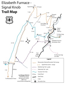
Signal Knob/Three Top Mountain Planimetric map

Ascending

Scoping out the trail shortly after leaving the trailhead

Like any other Woodsboy hike up until this one, nothing would have felt right if we didn’t manange to get lost looking for the trailhead.  Due to various descrepancies regarding the placement of the parking lot across two different maps, and in addition to the simple notion that we never thought to drive .1 miles further down the road, we eventually arrived at the start of our hike a whole two hours later than planned.  We even huddled to proclaim our “1, 2, 3, Woodsboys!” chant, before proudly starting down the wrong trail.  Even when we knew we weren’t on the right track, we somehow managed to trick ourselves into seeing more false trail.  Sayings like, “Maybe it’s marked by that ribbon on the tree over there, ” kept us tromping aimlessly through the snow covered brush, fooling ourselves into thinking we were making progress.  Finally, Matt went ahead (wherever ahead was) to scout the area.  He came back cursing, “Nothing but f**king deer trails!”  So, we knew it was time to re-think things.  We all backtracked to the car and decided to drive back out to the last road intersection mapquest sent us to, and measure the distance back in.  Turns out, just .1 past where we first were, was the Signal Knob parking lot.  So with night falling quickly, we set down the trail, hoping to make it the four and half miles up to our first night’s campsite.

Buzzard Rock

View from Buzzard Rock Overlook

The first part of the trail was flat until we turned northeast to start our first climb to Buzzard Rock overlook.  The ascent was rocky, but not totally impossible.  We were bogged down in winter layers, and taxed by the extra gear necessary for our warmth, so some decided to shed a few pieces of clothing to their pack in order to cool off.  For 20 degree weather, we felt pretty warm, and everyone seemed fairly confident that things weren’t going to be so bad.  We reached the overlook and took a short water break, and to admire the scenery underneath setting sun.  The snow against the mountain looked majestic beneath the barren trees.  Yet, the wind howled and reminded us to press on.

Fort Valley

Robert, Steven, and Matt at the Fort Valley Overlook

A hairpin turn at the overlook took us past a small, dry, campsite and the trail continued it’s ascent to the southwest towards Fort Valley Overlook.  After another .7 miles of moderately rocky trail we had arrived.  This one was even more beautiful than the last, so we stopped to take more pictures.  However, in the five minutes we stopped to admire nature, the sun had already disappeared behind the mountain.  At this point there was no more climbing, and the trail followed the ridge deep into the woods and away from the sunlight.  Immediately, the temperature dropped 10 degrees, the freezing sensation started tingling into our toes, and the wind was cutting through the exposed skin on our face.  When we reached our campsite it was nearly dusk, and we knew a fire was essential to our survival…

Stoking the Fire

Steven stokes the fire...

The next half-hour was nothing short of a frenzy at the campsite.  The fear of freezing to death was enough of a motivator to gather three piles of wood, sorted and chopped, before the night took us completely.  The team work was phenomenal.  At one point, Steven and Andrew were sawing, while Matt was getting kindling ready, all the while Robert kept tossing more downed wood onto our already impressive pile of wood.  Before the night was through, we had burned all of it.

Hell

Hell has frozen over.

Everyone had imagined we would sit around the fire, comfortably in our winter layers, eating and having a good time – albeit just being a bit colder.  In reality, we stood as close to the fire as possible without being in the flames, and talking was more a matter of distracting ourselves from the pain, rather than actually being interested in what the other person had to say.  Our Nalgene bottles were also freezing and had to be stored on the hot rocks to keep thawed.  Some melted at bit and grew narsty tumors before the night was through.

Bottles

Keeping our Nalgenes from freezing.

Sadly, there was only room enough for three people to stand around the fire at a time, and while Matt and Steven confidently claimed their spots, Andrew and Robert battled over the third spot (silently) the whole night.  If one stepped away for anything, the other would step in.  Once, when Andrew managed to reclaim the place of warmth, Robert recollects thinking, “Oh God, now I’m gonna die.”  And so, that’s how things went the rest of the night.  After every few seconds that one was away from the fire, they needed to come back.  Like a moth to a flame, we absorbed all the heat we could before we spared a few minutes to set up our tents, or hang the bear bag.  (Even though no bear was crawling out of their den that night.)  Steven sent his fingers into trauma staying out in the cold, trying to guide the rope over a tree branch with his gloveless hands.  He almost stuck his hand in the coals when returned.

Life

Life...

That night, after a few moments of fleeting cold, Steven and Andrew managed to fall asleep in their winter rated bags.  However, Matt and Robert clung to life the whole night, even wrapped in every layer of clothing they could find.  Robert gave up in the early morning, deciding that he might as well get up because if he fell asleep he would die.  When Steven woke in the night, he and Matt worked out a method of urinating into plastic water bottles (which is 98.7 degrees) and sleeping with them clutched against their chest.  They both reported sleeping very well after the piss stopped sucking away their internal heat, and could now be utilized to heat them inside their sleeping bags.

Campsite

Steven bids farewell to our campsite...with joy!

In the morning we smoked bacon over the fire, and after we ate Robert found an old Nintendo DS and threw it into the flames.  It made green smoke.  Just as we were going to head out on full day’s hike, we faced facts and decided it was too cold to continue.  We packed up camp and headed back the way we came.  The rocky descent was a bit more treacherous than the ascent, as the ice made a good foot hold hard to come by.  Robert stumbled hard and sprained his ankle on a rock.  Fortunately, we were on the warm side of the mountain, so we could spare the time to stop for him.  Steven whipped out his medical kit and gave him a good bandaging.  We divided up Robert’s gear and completed the last mile of our hike.  When we reached the car we sped to the nearest pizza joint and split a large meat lover’s pizza.  In addition, we each also ate our own footlong sub.

When we returned home, the temps reported for the night we were on the mountain was negative forty degrees, with wind chill!  It was a learning experience to say the least.

More Pictures:

Robert

The man is in pain.

Layers

Steven put his water bottles inside his coat to keep them warm.

Cold Night

It was a cold night.

Crowding the fire

Crowding the fire to stay warm...

Andrew

Andrew gazing out over Buzzard Rock Overlook.

Trail

Views along the Massanutten Trail.

The Forks of Red Creek: October 30 – November 1, 2009

•June 13, 2011 • Leave a Comment

This was a short 10 mile, “weekend warrior”, backpack in the Dolly Sods Wilderness, with Robert and Andrew being the only Woodsboy attendees.  The hike focused on the central Red Creek section of the plateau surrounding the area called The Forks.

Map

Red Creek Canyon Map - Dolly Sods

We parked at the Red Creek Campground at around 6:15 Friday night and intended to head a mile and a half west on Blackbird Knob Trail and camp just after the second creek crossing.  Darkness fell within ten minutes, so most of the hiking happened in the dark.  The tricky thing about Dolly Sods is that none of the trails are blazed, so with night falling, navigation wasn’t on our side.  Because of the low visibility we missed a key arrow pointing us to the left as the trail left a pine thicket (we realized this later), so we wandered on forward following a faint trail that was marked with rock cairns.  This was strange, because if it wasn’t in fact the trail, it was also clearly marked with glow-in-the-dark markers no bigger than a penny.  Just as we would stop and assume we were lost, we would see another marker.  At one point, we emerged into a clearing (still not knowing we were off the trail at this point) and the faint trail we had been following was no place to be found.  We saw a glowy thing off in a thicket, but when we pushed towards it, everything was so overgrown we assumed that it couldn’t’ be right.  We backtracked, and still found nothing.  We didn’t understand where the trail was going.  In the distance a coyote howled.  “This sucks,” Robert said.  We walked around in circles for ten minutes, I could start to see my breath, so the temperature was dropping.  Fortunately we were both fleeced up.  Again, we tried pushing through the brush towards the faint glowy marker we saw, but half way there we always felt strange that it was leading us deeper into the thicket so we turned around.  Suddenly, the coyotes howled again, this time…not too far away.  Decision time set in fast, and we decided just to run through the thicket until we got to the glowy marker.  When we reached the point where we normally would turn around, we kept going.  Just as we thought it was time to call it a night and just camp somewhere, we emerged onto the trail.  We should have trusted the marker all along!  (On the way back, two days later, we finally realized we had accidentally gone off the trail that night onto a popular detour taken by hikers.)

The rest of the trail was thankfully well beaten and it was cinch to follow to the second stream crossing.  We scored a sweet campsite on an island in the middle of red creek.  The temps rose into the hight 60s, and there was a full moon with no clouds.  We ate grilled chicken and then called it a night after enjoying our campfire.

Day 2 we packed up camp and headed west on blackbird knob trail.  The plan was to get down to the forks for the 2nd night’s campsite.  The trail crossed through some open mountain meadows, that were spectacular.  The terrain was gentle and rolling, however, it was raining off and on like crazy, and the trail started feeling more like hiking through a stream rather than a trail.  At one point, Robert even asked if we were still following a trail.  We reached the intersection of Rocky Ridge Trail and headed south for .5 miles until we hit the three way intersection of Breathed Mountain, Big Stonecoal and Rocky Ridge.  We paused for a moment to marvel at the inaccuracy of the maps posted by the Forest Service before heading east on Breathed Mountain.  We crossed through some mucky, boggy flatlands for a mile or so, until we descended to the intersection of Red Creek Trail.  That trail headed north for a beat, bringing us to “the forks,” the spot where both forks of red creek converge to create a natural water park, with some descent swimming holes and rock slides.  On holiday weekends this area is typically packed with campers.  As a result, there is virtually no firewood to found ANYWHERE.  Our best luck came when we raided empty campsites for left over wood in their fire rings.  We scored a sweet spot right on the peninsula.  The waterfall was a bit noisy, but Andrew found the white noise to be soothing – Robert highly disliked it.

The Forks

The Forks of Red Creek...photo courtesey of the Sierra Club


It was still drizzling a bit that night so we had significant troubles getting the fire going.  A gust of wind kept blowing water off the trees onto our baby flames.  We wandered over to some nearby campers to ask for help and one guy told us about the trick of using birch bark for kindling – it burns even when wet.  So once we got our fire going we hung out with those guys the rest of the night.  They were from Charlottesville, and part of a hiking club.  We talked for about two hours before we retired to our tents, we didn’t even get there names.

The following morning we ascended the final two miles out of the valley, and away from Red Creek, rejoining Blackbird Knob, heading east back to our car.

Allegheny Front Trail: July 24 – 27, 2009

•June 10, 2011 • Leave a Comment

Located in the Moshannon State Forest, the AFT, is a 42 mile loop that circumnavigates Black Moshannon State Park, and skirts the rocky slopes of the Allegheny Front on its southeastern vista section.   As a bird flies, the trail is only 15 minutes from State College, and two miles from the, now defunct, mid-state airport.

Map

Planimetric AFT Map

Trailhead

Scoping out the route at the trailhead

We (Matt, Steven, Robert, and Andrew) parked at the intersection of Six Mile Run Rd and PA504 (Rattlesnake Pike), and donned our packs.  The plan for day 1 was tohead north around the loop for about ten miles before we set up camp.  However, after poking around for about five minutes in the woods, the trail wasn’t readily visible to us, so we ended up going south, since that was the only blaze we could see.  This, unfortunately, became a theme of the hike, as trail maintenance hadn’t been back to AFT for a while, and sometimes the route wasn’t clearly marked.

Pine Plantations

Following an old logging through some pine plantations

We had a bit of a late start, but the first couple of miles flew by as we followed Six Mile Run upstream before we turned west, away from it, and hiked deep into the pine plantation of Moshannon Forest.  When PA was severly logged during the early part of the century, acres of land along the ridge were left barren, so thousands of pine trees were transplanted back to the area to repair some of the damage.  The trail then crossed Six Mile Run and followed a paved road briefly before heading up a short steep climb.  The five or so miles that followed we called “the Shithole” because of the way the brush encroached over the trail, reducing your visibility to a few feet.  Part of it also had been recently logged (by the same forest service that repaired the logging done a few miles back, no doubt), so the trees with the blazes were gone, and we were forced yet again to find our bearings.

Cooking

Steven cooks dinner on night 1

When we were free of this zone, we descended back down to Six Mile Run where we filled our water and scoped out for a campsite for the evening.  We found an old hunters camp near a fresh water spring and decided to call it a night.  Steven cooked chicken breasts with roasted peppers and onions on the campfire and they were a juicy good time.  We retired for the night in our tents with the noise of a house party lulling us into sleep.

Swamp

The swamps on the Moss Hanne Trail

Day 2 we decided to make up for lost time, since we estimated only doing about 6 and a half miles the day before.  Andrew had read there was a nice plush campsite just past the intersection of 504 on the eastern side of the loop, so we aimed for that and set out.  The next couple of miles followed Six Mile Run further upstream before we left it for good and headed east toward Black Moshannon State Forest.  After we ascended an old logging road the blazes randomly changed colors, so there was a brief backtrack before Steven calculated that we were indeed still on the right track.  We followed the red blazes for a few miles, and when they changed back to orange we did a victory dance.  The next phase of the hike took us around Black Moshannon lake where the AFT shared itself with the Moss Hanne Trail.  This zone was a swamp, to say the least.  We tromped through the mud and emerged on the other side of the park to eat lunch.  We had done about 7 miles and we needed to refill our water.  Andrew’s Steripen, unfortunately died, and without any other way of sterilizing, we boiled water for a while on the bridge before heading off towards the southeastern vista section of the trail.

Vistas

Steven, Andrew, and Robert taking a break in the vista section

This is the zone of the trail from which it was named, and all of us, still hold vivid memories of our experience across the next three miles.  It was thundering, the daylight was poor, and we were soaking wet from a freak rainstorm that had soaked us in two minutes.  The tail here was very up and down, and very rocky, and was starting to take a toll on the blistered feet in the group.  There were many close calls, but hiking sticks saved all the falls.  There were also some pretty nice views, but nobody cared.  Everyone was dreaming of getting to the campsite and having a fire.  But before us loomed about a 600 foot climb without the aid of switchbacks.  We took it one step at a time, and Steven coached us all up the hill.  We were nearly dead when we reached the top, and hoped that was the last of it.  Alas, we descended briefly and were faced with another seemingly un-ending climb.  Muscles ached, and lungs gasped for air.  When Andrew stopped for a break, extremely fatigued, Matt proclaimed, “we’re all gonna die!” in a goofy voice, and it elevated the moment.  We trudged to the top of the hill and found PA 504 waiting for us – never was there such relief…we knew the campsite was close.

Campfire

Our campfire at our second campsite

However, when the meadow arrived there was no campsite to be found.  The creek that it was supposedly next to was dried up, so with darkness falling we had no choice but to press on.  A mile later we came to the trail’s first intersection with Rock Run, a wimpy little stream barely wider than a foot and still no campsite.  There was almost an audible silence as we all assumed we would probably have to bushwack a campsite, until Steven trotted up the hill to scope it out…and found…a campsite- hidden away.  We dropped our packs and did some high fives.  We had done more than 12 miles that day and the victorious rush of adrenaline was a welcome mood changer.  That night Steven cooked some black beans and rice with Salmon and we ate ravenously.  The rain came in five second waves that night, and Steven kept doing his imitation of Daniel Day Lewis in There Will Be Blood (“It’s Called Drainage!”).  It kinda became the theme of the hike.

Brenner Run

Robert, Matt, and Steven over Brenner Run

Day 3 we let ourselves sleep in and didn’t hit the trail until a little after noontime.  Since we had gone so far the day before we eased up a little on our legs.  The trail led us past the Rock Run Trail system to the northeast, and we climbed over a ridge that would take us down to Brenner Run.  The scenery along this stretch was nothing short of fantastic, as Rhododendron lined the banks of the crystal clear water, and there was a little humidity in the air, that gave everything a hazy sparkle.  After about five miles of hiking, we stopped for lunch over the run before heading off over Black Moshannon Creek.  Our only big climb of the day took us away from Black Mo and up to an old logging road that sent us north for about a mile and a half.  We passed someone’s mountain home and the guy was out mowing his yard.  We asked him if he knew any good campsites coming up in the next couple miles, and he said “no.”  We still joke that we wished he would have said we could camp in his yard, because we saw a fire ring, but alas we pressed on.  The fire road gently descended down to the banks of the big Red Mosshannon Creek, and red it was.  With PA being a large coal mining community, large amounts of iron had leaked into the water decades ago, forever turning the creek a dark blood red and earning its nickname the “Red Mo.”    Just as dusk was upon us we came across a beautiful campsite near Potter’s Run and feasted into the night on more of Steven’s delectable campfire cooking.  The sounds of I-90 nearby were faint, but sung us to sleep.

Red Mo

View of the Red Moshannon Creek

The last day we crawled from our sleeping bags, with our leg muscles screaming at us.  Cleaning up camp was slow, but we hit the trail around noon, to complete the loop with the last ten miles.  About  two miles later we discovered that we were actually farther along than we thought we were.  Since the AFT was so poorly marked, we had no tagible knowledge up to that point about our exact distance.    In fact, we had only about 2 and a half miles to go at that point.  Also, and even more exciting, we realized we must have hiked at least 18 miles on Day 2 instead of 12 like we thought!  We stopped for a break, figuring now we could spare the time, and boiled the last of our water.  When we set off, the trail rejoined Six Mile Run from the north, we followed it downstream back to the trailhead.  About five minutes before the end of our hike, Robert’s, hand-me-down, external frame, pack, broke and his sleeping bag went rolling down into the water.  Stunned at his luck, more than the event of it happening at the moment, he retrieved it and we sang “We are the Champions” as we ran toward the car.  We GPS’d Outback Steak House and all gorged on babyback ribs before we made the three hour drive home.

More Pictures:

Matt

Matt, after traversing the Vistas...

Water Break

Robert, Andrew, Steven on a logging road on Day 1


Logging

an area recently logged...

Wolf Rocks

Passing through Wolf Rocks on Day 2

Brenner Run

Views of Brenner Run through a Rhodohdendron thicket

Steven

Steven consults the map...